Karnataka’s diverse geography stretches across 191,791 square kilometers, encompassing six distinct physiographic regions that form the backbone of competitive examinations for forest guard positions and state-level civil service tests. Understanding this terrain proves essential for candidates appearing in Karnataka Public Service Commission (KPSC) exams, where questions on physical geography, climate zones, and ecological divisions consistently appear across written papers and interview rounds.
Table of Contents
Physiographic Divisions Tested in State Exams
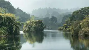
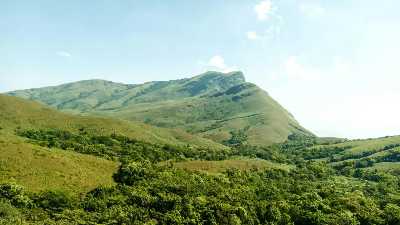
The state divides into six major physiographic regions, each presenting unique characteristics that examiners frequently reference in question papers. The coastal plains along the Arabian Sea extend approximately 320 kilometers, featuring laterite soil formations and heavy monsoon precipitation exceeding 3,000 millimeters annually in certain districts. The Western Ghats, designated as a UNESCO World Heritage Site, rise abruptly from these plains and harbor over 5,000 flowering plant species — a biodiversity concentration that appears regularly in ecology-focused questions.
The Malnad region, characterized by dense forests and undulating terrain between 600 and 900 meters elevation, transitions into the Bayaluseeme or Maidan plateau region. This interior plateau, comprising nearly two-thirds of Karnataka’s land area, experiences semi-arid conditions with annual rainfall below 750 millimeters in northern districts. Exam questions often contrast these climatic variations, requiring candidates to identify corresponding agricultural patterns and water resource challenges.
| Physiographic Region | Area Coverage | Key Geographic Features | Exam Focus Areas |
|---|---|---|---|
| Coastal Plains | Uttara Kannada, Udupi, Dakshina Kannada | Laterite soil, estuaries, mangrove patches | Coastal ecosystems, monsoon patterns |
| Western Ghats | Continuous mountain chain | Elevation 900-1,800m, evergreen forests | Biodiversity hotspots, endemic species |
| Malnad | Hill region east of Ghats | Coffee plantations, perennial streams | Plantation economy, soil types |
| Northern Maidan | Black soil region | Deccan trap formations, low rainfall | Drought management, cropping patterns |
| Southern Maidan | Granite-gneiss complex | Tank irrigation systems, scrub forests | Water conservation, degraded forests |
| Eastern Plateau | Border districts | Undulating terrain, deciduous forests | Interstate river disputes, mining impacts |
River Systems and Drainage Patterns
Karnataka contains seven major river basins that drain into either the Bay of Bengal or the Arabian Sea, creating a watershed divide that influences forest distribution and administrative boundaries. The Krishna and Cauvery basins together account for approximately 64 percent of the state’s geographical area, while west-flowing rivers like Sharavathi, Netravati, and Kali drain the Western Ghats region through steep gradients.
According to Central Water Commission river basin details, the Cauvery basin within Karnataka covers 34,273 square kilometers across 11 districts, supporting both irrigated agriculture and significant forest cover in its upper catchments. Forest guard examinations frequently test knowledge of river origins, tributaries, and associated protected areas. The Sharavati River, originating in the Shimoga district, flows through Jog Falls before reaching the Arabian Sea — a geographic landmark that appears in multiple-choice questions alongside queries about hydroelectric projects and their environmental impacts.
Forest Types and Vegetation Zones

Champion and Seth’s forest classification system categorizes Karnataka’s vegetation into 24 distinct forest types, ranging from tropical wet evergreen forests in the Western Ghats to thorn scrub formations in northern districts. The state’s recorded forest area stands at 43,356 square kilometers, representing 22.6 percent of total geographical area — a statistic that candidates must recall accurately during examinations.
Evergreen forests persist above 1,500 meters elevation in regions receiving over 2,500 millimeters of annual rainfall, dominated by species like Dipterocarpus indicus, Hopea parviflora, and Mesua ferrea. As elevation decreases and rainfall diminishes, these transition into moist deciduous forests featuring teak, rosewood, and bamboo species. The dry deciduous forests covering the Maidan region support economically valuable species such as sandalwood, which appears prominently in conservation-related exam questions.
Protected Areas and Wildlife Corridors
Karnataka maintains five national parks and 25 wildlife sanctuaries that together encompass approximately 6,000 square kilometers. Nagarhole, Bandipur, and Bannerghatta national parks form critical tiger habitats, while lesser-known sanctuaries like Ranganathittu and Attiveri protect wetland ecosystems. Forest guard candidates must memorize the year of establishment, area extent, and flagship species for each protected area, as descriptive questions routinely demand this information.
The Mysore-Nilgiri corridor connects Karnataka’s southern forests with Tamil Nadu and Kerala, facilitating elephant movement across state boundaries. Understanding these ecological corridors proves essential for answering scenario-based questions about human-wildlife conflict mitigation and habitat connectivity.
Climate Zones and Agricultural Geography
Karnataka experiences four distinct seasons: southwest monsoon from June through September, northeast monsoon during October and November, winter from December through February, and summer spanning March to May. The Western Ghats intercept southwest monsoon winds, creating an orographic effect that produces rainfall exceeding 5,000 millimeters in Agumbe India Meteorological Department rainfall distribution, while districts like Raichur and Koppal receive less than 600 millimeters annually.
This climatic gradient determines agricultural zones that examiners correlate with forest distribution patterns. The coastal and Malnad regions support plantation crops including coffee, cardamom, and areca nut, while the Maidan plateau relies on rainfed crops such as ragi, jowar, and groundnut. Questions linking agro-climatic zones to soil erosion rates, forest fragmentation, and land use changes appear consistently in environmental studies sections.
Strategic Study Approach for Geography Topics
Successful candidates allocate study time across three priority areas: physiographic divisions with associated climate data, river systems including interstate water disputes, and forest types correlated to elevation zones. Creating comparison tables that juxtapose rainfall figures, dominant vegetation, and soil types across regions enables rapid recall during examinations. Mapping exercises that trace river courses, mark protected areas, and delineate agro-climatic zones reinforce spatial understanding that proves invaluable during descriptive answer writing.
Recent exam trends show increased emphasis on environmental impact questions linking geography to conservation challenges. Candidates benefit from integrating knowledge of Western Ghats ecology with current afforestation programs, or connecting drought-prone district identification with social forestry initiatives. This interdisciplinary approach transforms geographic facts into analytical frameworks that score higher marks in subjective papers and demonstrate practical competence during interview rounds.