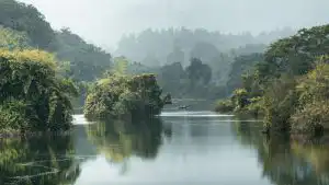
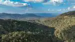
Karnataka’s forest boundaries, spanning over 38,000 square kilometers of protected woodland, rely on precise demarcation systems that blend traditional surveying methods with modern geospatial technology. Understanding how these boundaries are established and maintained reveals the complex intersection of legal frameworks, conservation priorities, and community land rights across the state.
Table of Contents
Legal Framework Governing Forest Boundary Demarcation in Karnataka
The Karnataka Forest Act of 1963 provides the statutory foundation for boundary demarcation, working in conjunction with the Indian Forest Act of 1927. Reserved forests and protected forests follow distinct notification procedures. Reserved forests undergo a multi-stage process beginning with a preliminary notification under Section 4, followed by a settlement of rights inquiry, and culminating in a final notification that legally establishes boundaries. Protected forests, which constitute roughly 17 percent of Karnataka’s forest area, follow a simpler declaration process but still require clear physical demarcation.
The Forest Survey of India conducts periodic assessments that inform boundary verification. State forest departments maintain cadastral maps showing exact coordinates, village interfaces, and encroachment zones. According to Karnataka Forest Rules 1969, each forest division must update its boundary records every five years to account for natural shifts and resolve disputes.
Physical Marking Systems Used Across Karnataka’s Forests
Boundary pillars form the primary physical markers along forest perimeters. These concrete or stone pillars, typically 1.2 meters tall with a 30-centimeter base, are installed at intervals ranging from 50 to 200 meters depending on terrain complexity. Each pillar bears inscriptions identifying the forest division, range, and sequential numbering. The Western Ghats forests in Uttara Kannada and Kodagu districts feature higher pillar density due to irregular topography and extensive private land interfaces.
Trenches supplement pillar systems in accessible areas. These earthworks, usually one meter deep and 0.6 meters wide, create visible linear demarcations that discourage casual encroachment. Paint blazes on trees provide interim markers between permanent installations, using standardized color codes: white for reserved forests and yellow for protected forests. Satellite-based GPS coordinates now accompany all physical markers, creating redundant verification systems.
| Demarcation Method | Primary Use Case | Maintenance Frequency | Typical Lifespan |
|---|---|---|---|
| Concrete Pillars | Permanent boundaries, high-dispute areas | Annual inspection | 25 to 30 years |
| Stone Markers | Rocky terrain, heritage forests | Biannual inspection | 50+ years |
| Boundary Trenches | Flat terrain, agricultural interfaces | Every 3 years | 5 to 8 years |
| GPS Coordinates | All boundaries (digital record) | Continuous monitoring | Permanent digital asset |
| Paint Blazes | Interim marking, dense forest | Annual repainting | 1 to 2 years |
Technological Integration in Boundary Protection

Karnataka has adopted Geographic Information System mapping across all 30 territorial forest divisions. High-resolution satellite imagery from ISRO’s RISAT and Cartosat missions enables annual change detection analysis. Forest officials overlay current imagery with historical boundary data to identify encroachments within 10 meters of accuracy. The state’s Forest Management Information System integrates these spatial datasets with ground verification reports.
Mobile applications now equip field staff with real-time boundary reference tools. Rangers use handheld GPS devices that display cadastral boundaries, pillar locations, and nearest patrol routes. When encroachment is detected, geotagged photographs and coordinates feed directly into district-level monitoring dashboards. Bangalore’s Forest Department headquarters receives automated alerts when unauthorized activity occurs within 500 meters of protected boundaries.
Community Participation and Dispute Resolution Mechanisms
Joint Forest Management Committees, active in over 6,000 villages bordering Karnataka’s forests, participate in boundary maintenance activities. These committees include elected village representatives, forest officials, and local stakeholders. Members conduct quarterly boundary walks, reporting damaged markers and vegetation changes. The Scheduled Tribes and Other Traditional Forest Dwellers Act of 2006 introduced additional layers of community forest rights verification, requiring boundary adjustments where customary claims are proven.

Dispute resolution follows a tiered approach. Initial conflicts between forest boundaries and private claims go to Deputy Conservators of Forest for investigation. Unresolved cases escalate to the District Collector, then to the Karnataka Forest Appellate Authority. According to [CITE: forest boundary dispute statistics Karnataka 2023], approximately 340 boundary disputes were adjudicated across the state last year, with 62 percent resolved through negotiated boundary corrections and compensation rather than legal enforcement.
Ongoing Challenges and Enforcement Strategies
Encroachment remains the primary threat to boundary integrity, particularly in high-value areas near Bangalore, Mysore, and Mangalore. Unauthorized agricultural expansion accounts for 48 percent of boundary violations, followed by construction activities and mining operations. Forest departments conduct annual verification drives, cross-referencing revenue records with forest cadastre to identify discrepancies.
Enforcement relies on patrol density and response time. Critical zones receive weekly inspections, while remote areas operate on monthly cycles. Violators face prosecution under the Forest Act, with penalties including demolition of unauthorized structures, land restoration costs, and imprisonment for repeat offenders. Karnataka has established 18 special forest courts to expedite boundary violation cases, reducing average case disposal time from 4.3 years to 1.7 years since their inception.
Protecting forest boundaries requires sustained institutional commitment, technological adaptation, and community cooperation. As Karnataka balances development pressures with conservation mandates, the precision and transparency of boundary systems will determine how effectively these vital ecosystems are preserved for future generations.