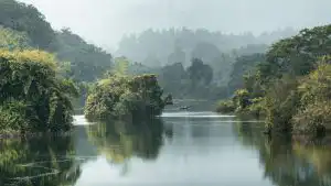
Karnataka’s forests span approximately 38,720 square kilometers, covering nearly 20 percent of the state’s geographical area. These ecosystems play a direct role in regulating monsoon patterns and maintaining groundwater levels across the Western Ghats and Deccan Plateau regions. Understanding the mechanisms behind forest-rainfall interactions helps explain why deforestation in districts like Uttara Kannada and Kodagu correlates with declining water availability in downstream agricultural zones.
Table of Contents
The Transpiration-Precipitation Cycle
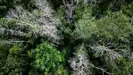
Forest vegetation functions as a biological water pump. Trees absorb groundwater through root systems and release moisture into the atmosphere through leaf pores in a process called transpiration. A single mature tree can transpire 200 to 300 liters of water daily during growing seasons. When this moisture rises and condenses, it forms clouds that contribute to localized rainfall patterns.
Research demonstrates that forested regions generate 20 to 30 percent more precipitation than cleared landscapes of equivalent size. The Western Ghats exemplify this relationship. Dense evergreen forests along the Karnataka coast receive annual rainfall exceeding 3,000 millimeters, while the eastern rain shadow areas with sparse vegetation record less than 600 millimeters. This disparity reflects how vegetation density influences atmospheric moisture content.
Forests also affect rainfall timing and distribution. Tree canopies slow raindrop velocity, reducing soil erosion while allowing gradual water infiltration. According to [CITE: forest hydrology studies India Meteorological Department], areas with intact forest cover experience 40 percent less surface runoff compared to deforested slopes, meaning more water enters aquifers rather than flowing away as flash floods.
Groundwater Recharge Mechanisms
Root systems create channels in soil that function as natural conduits for water absorption. In Karnataka’s laterite and red soil zones, tree roots penetrate three to five meters deep, breaking compacted layers and enhancing permeability. This biological engineering allows monsoon water to percolate into underground reservoirs that supply wells and borewells during dry months.
Leaf litter and organic matter improve soil structure. A healthy forest floor can absorb rainfall at rates up to 18 times faster than cleared agricultural land. The humus layer acts as a sponge, temporarily storing water before gradual release into deeper geological formations. Forests in the Cauvery basin demonstrate this capacity, with wooded catchments maintaining stream flow three to four months longer than non-forested watersheds after monsoon cessation.
| Land Cover Type | Water Infiltration Rate (mm/hour) | Annual Groundwater Recharge (mm) | Dry Season Stream Flow (months) |
|---|---|---|---|
| Dense Forest | 180-220 | 450-600 | 8-10 |
| Degraded Forest | 80-120 | 200-350 | 4-6 |
| Agricultural Land | 40-70 | 100-180 | 2-3 |
| Urban/Barren | 10-25 | 30-80 | 0-1 |
Temperature Regulation and Moisture Retention
Forest canopies reduce ground-level temperatures by four to eight degrees Celsius compared to open areas. This cooling effect decreases evaporation rates, allowing soil moisture to persist longer between rainfall events. Shade-protected soil in Bandipur and Nagarhole reserves retains moisture content 60 percent higher than exposed land during pre-monsoon months.
Lower temperatures also affect local wind patterns and cloud formation. Cooler forest air creates pressure differentials that draw moisture-laden winds inland from coastal regions. This convection mechanism supplements the monsoon’s primary circulation, generating additional rainfall in forested hill stations like Agumbe, which records India’s second-highest annual precipitation at approximately 7,000 millimeters.
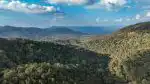
Watershed Protection Services
Forests stabilize slopes and prevent sediment from clogging rivers and reservoirs. The Krishna Raja Sagara dam, which supplies water to Mysuru and Mandya districts, depends on forested catchments in the Western Ghats. Studies show that [CITE: reservoir sedimentation rates Karnataka forest watersheds], protected forest catchments experience 70 percent less siltation than degraded areas, extending reservoir lifespan and storage capacity.
Riparian forests along river corridors filter nutrients and pollutants before they enter water bodies. Tree roots stabilize banks, reducing erosion during flood events. The Tungabhadra and Sharavathi river systems benefit from gallery forests that maintain water quality while supporting aquatic biodiversity.
Implications for Water Security
Karnataka faces growing water stress as urbanization and agricultural expansion reduce forest cover. Bangalore’s water crisis intensifies partly because surrounding catchment areas have lost protective vegetation. Restoring degraded forests and protecting existing stands directly impacts long-term water availability for Karnataka’s 68 million residents.
Agroforestry and community forestry programs offer practical solutions. Planting native species like tamarind, jackfruit, and sandalwood in farm boundaries increases local rainfall while providing economic returns. Village forest committees in Hassan and Chikmagalur districts demonstrate how participatory conservation models improve both ecological health and rural livelihoods.
The relationship between forests and water security extends beyond environmental concerns to economic stability and public health. Recognizing forests as infrastructure for rainfall generation and aquifer recharge should inform land-use policies, particularly in ecologically sensitive zones where deforestation creates cascading impacts across entire river basins.