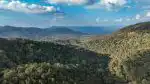
Karnataka’s diverse landscape — from the Western Ghats to the Deccan Plateau — faces recurring challenges with soil degradation and seasonal flooding. Forests function as natural infrastructure that stabilizes land and regulates water flow, offering protection that engineered solutions struggle to replicate at scale. Understanding these mechanisms clarifies why forest conservation directly impacts agricultural productivity, urban water security, and disaster resilience across the state.
Table of Contents
Soil Stabilization Through Root Systems
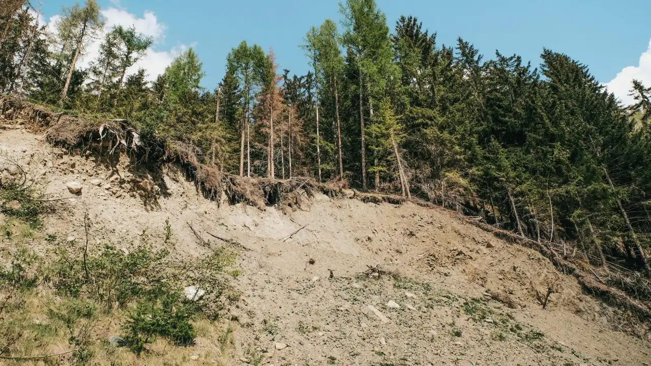
Tree roots create an underground network that physically binds soil particles together. In Karnataka’s hilly regions like Chikmagalur and Kodagu, this binding prevents surface soil from washing away during monsoon rains. Shallow-rooted grasses and shrubs hold the top layer, while deeper tree roots anchor the subsoil, creating a multi-tiered stabilization system.

When forests are cleared for agriculture or development, this structural support disappears. The resulting loose soil becomes vulnerable to sheet erosion, where rainwater carries away thin layers of topsoil. Over time, this depletes the nutrient-rich surface layer essential for farming. According to soil erosion in Karnataka agricultural lands, districts with reduced forest cover experience significantly higher rates of topsoil loss during heavy rainfall events.
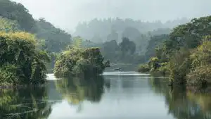
The Western Ghats forests demonstrate this protective function at landscape scale. These forested slopes act as buffers for downstream agricultural areas in Hassan, Mandya, and Mysuru districts. Without this vegetative cover, the productive black soil and red loam zones would face accelerated degradation, directly threatening the state’s agricultural output.
Water Absorption and Runoff Control
Forest canopies intercept rainfall before it strikes the ground, reducing the force of impact. A single mature tree in Bannerghatta or Nagarahole can capture hundreds of liters during a storm, with water dripping slowly to the forest floor rather than hitting soil at full velocity. This seemingly minor difference prevents surface compaction and crusting.
Below ground, forest soils contain significantly higher organic matter than cleared land. This spongy layer absorbs water like a reservoir, gradually releasing it into streams and aquifers. During Karnataka’s southwest monsoon, forested watersheds regulate peak flows, preventing the sudden surges that cause flash flooding in urban areas like Bengaluru and Belagavi.
| Land Cover Type | Water Infiltration Rate | Surface Runoff | Erosion Vulnerability |
|---|---|---|---|
| Dense Forest | High (80-90%) | Minimal (10-20%) | Very Low |
| Degraded Forest | Moderate (50-60%) | Moderate (40-50%) | Moderate |
| Agricultural Land | Low (30-40%) | High (60-70%) | High |
| Barren/Paved Land | Very Low (5-10%) | Very High (90-95%) | Extreme |
The contrast becomes visible after deforestation. Bare soil reaches saturation quickly, forcing excess water to flow overland. This runoff gathers speed on slopes, cutting gullies and carrying sediment into rivers. The Cauvery and Krishna river systems both show elevated sediment loads in reaches where upstream forest cover has declined.
Practical Implications for Karnataka Communities
Farmers in Raichur, Kalaburagi, and Vijayapurga districts experience the downstream effects of degraded watersheds. Eroded topsoil from deforested areas accumulates in reservoirs, reducing storage capacity and irrigation potential. According to sedimentation in Western Ghats South India, several Karnataka dams have lost substantial volume to siltation over recent decades.

Urban flood risk increases when upstream forests disappear. Bengaluru’s recurring inundation problems stem partly from reduced absorption capacity in surrounding catchment areas. Developments in Sarjapur, Electronic City, and northern suburbs have replaced forests and wetlands with impervious surfaces, eliminating natural water storage and increasing runoff volumes that overwhelm drainage infrastructure.
Forest restoration initiatives in Uttara Kannada and Shivamogga demonstrate measurable benefits. Replanted slopes show reduced landslide frequency, clearer stream water, and improved groundwater recharge. These changes translate to economic value through enhanced agricultural yields, lower water treatment costs, and reduced disaster recovery expenses.
Career Opportunities in Forest Management
Karnataka’s emphasis on watershed restoration and eco-restoration projects creates demand for professionals trained in forestry, hydrology, and environmental science. The Karnataka Forest Department regularly recruits for positions including forest guards, range officers, and technical specialists focused on soil conservation and catchment management.
Private sector opportunities exist with organizations working on agroforestry, carbon sequestration projects, and ecological consulting. Job seekers with skills in GIS mapping, environmental impact assessment, or community forestry find roles with NGOs operating in districts like Dakshina Kannada, Udupi, and Chamarajanagar. Technical training in erosion control techniques and watershed planning strengthens employability in this growing field.
Individual and Community Action
Protecting existing forests begins with supporting policies that prioritize conservation over short-term extraction. Residents can participate in local Forest Rights Committees, which manage community forests under the Forest Rights Act. These committees make decisions about sustainable harvesting, fire prevention, and degraded area restoration.
Urban dwellers contribute by advocating for preservation of city forests and green belts. Cubbon Park, Lalbagh, and similar spaces provide miniature versions of forest functions — absorbing rain, filtering air, and reducing heat island effects. Opposing development proposals that threaten these areas protects essential ecological infrastructure.
Farmers can adopt agroforestry practices that blend crop production with tree cover, gaining erosion protection without sacrificing productivity. Planting native species along field boundaries, in gullies, and on steep slopes stabilizes soil while generating secondary income from timber, fruit, or fodder. Extension services through agricultural universities in Dharwad and Bengaluru offer technical guidance for implementation.
Karnataka’s forests represent critical assets for climate adaptation and economic stability. Their capacity to prevent soil loss and regulate water flows protects agricultural land, maintains river health, and reduces disaster costs. Sustaining these benefits requires coordinated effort across government agencies, local communities, and individual landowners who recognize forests as functional infrastructure rather than merely scenic backdrops.