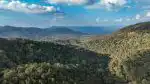
The Western Ghats stretch across Karnataka for over 500 kilometers, forming a natural barrier between the coastal plains and the Deccan Plateau. This mountain range shapes the state’s climate, supplies water to millions, and harbors species found nowhere else on Earth. For Karnataka residents, these forests are not distant wilderness — they determine whether taps run dry in Bengaluru, whether coffee grows in Chikmagalur, and whether monsoons arrive on schedule.
Table of Contents
Biodiversity That Exists Nowhere Else
Karnataka’s section of the Western Ghats contains 38 percent of the range’s total forest cover, making it the single largest state contributor to this UNESCO World Heritage Site. The region supports over 5,000 species of flowering plants, 508 bird species, and 179 amphibian species. According to Western Ghats endemic species biodiversity, approximately 325 globally threatened species depend on these forests for survival.
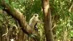
The Lion-tailed Macaque exists only in these evergreen forests, while the Malabar Giant Squirrel and Nilgiri Tahr occupy narrow elevation bands. Losing forest patches does not simply reduce numbers — it erases entire genetic lineages. The Sharavathi Valley alone contains 28 species of butterflies recorded nowhere else in India.
Endemic species concentrate in Karnataka’s Western Ghats because the terrain creates isolated pockets where evolution proceeds differently. A ridge in Kodagu may harbor frogs genetically distinct from populations 50 kilometers away in Hassan. This biological wealth translates directly into pharmaceutical potential, agricultural resilience, and ecosystem stability that benefits the entire state.
Water Security for Urban and Rural Karnataka
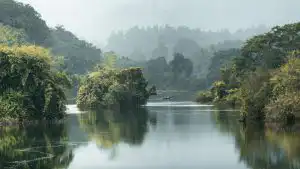
Every major river serving Karnataka originates in the Western Ghats. The Cauvery, Tungabhadra, Krishna, and Netravati all begin as small streams in these forested highlands. Bengaluru draws over 1,450 million liters daily from the Cauvery basin — water that falls first as rain on Ghats forests in Kodagu and Chikmagalur districts.
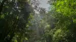
Forest cover in the Western Ghats functions as a natural water tower. Tree canopies intercept rainfall, allowing gradual soil infiltration rather than rapid runoff. This process recharges aquifers, maintains base flow in rivers during dry months, and prevents the catastrophic siltation that shortens reservoir lifespans. The Linganamakki reservoir on the Sharavathi River, which powers hydroelectric stations supplying Bengaluru and Mangaluru, depends entirely on forested catchment areas upstream.
When forest cover declines, monsoon water rushes directly into rivers, causing floods in July and August, then leaving riverbeds dry by February. Coastal districts like Dakshina Kannada experience this cycle acutely — excessive August flooding followed by March water scarcity. Intact forest buffers both extremes, storing water during surplus and releasing it during deficit.
| District | Western Ghats Coverage (%) | Primary Rivers Originating | Dependent Population (millions) |
|---|---|---|---|
| Kodagu | 82 | Cauvery, Hemavati | 8.5 |
| Chikmagalur | 67 | Tunga, Bhadra | 6.2 |
| Hassan | 41 | Hemavati, Netravati | 4.8 |
| Shivamogga | 58 | Sharavathi, Tunga | 5.3 |
| Uttara Kannada | 89 | Kali, Gangavali | 2.1 |
Climate Regulation Beyond State Borders
The Western Ghats influence monsoon patterns across peninsular India. Mountain slopes force moisture-laden winds upward, creating orographic rainfall that extends inland. According to Western Ghats monsoon precipitation patterns, the range intercepts 70 percent of monsoon moisture before it reaches the Deccan Plateau, generating rainfall totals exceeding 6,000 millimeters annually in Agumbe and surrounding areas.

This rainfall distribution affects agriculture across Karnataka. Paddy cultivation in Mandya, ragi fields in Tumakuru, and sugarcane in Belagavi all depend on reservoir storage and groundwater recharged by Ghats rainfall. When forest degradation reduces rainfall reliability, cropping patterns shift, yields decline, and farmer distress increases.
The forests also sequester carbon at rates among the highest globally. Evergreen forests in Kodagu and Uttara Kannada store between 200 and 400 tons of carbon per hectare, offsetting emissions from Karnataka’s industrial and urban centers. This carbon storage provides no immediate financial return to landowners, yet delivers climate stability benefits felt statewide.
Economic Value Rooted in Forest Health
Coffee plantations covering 400,000 hectares in Karnataka depend entirely on Western Ghats microclimates. Shade-grown coffee requires specific temperature ranges, rainfall patterns, and soil moisture levels that exist only under intact forest canopy. Chikmagalur and Kodagu together produce 70 percent of India’s coffee — an industry employing 600,000 people directly and supporting over two million livelihoods indirectly.
Spice cultivation, particularly cardamom and pepper, functions similarly. These crops grow as understory plants in forest margins, requiring the humidity, shade, and pollinator populations that healthy forests maintain. Degraded forests lose pollinator diversity, reducing yields by 30 to 50 percent even when rainfall remains adequate.
Tourism revenue tied to Western Ghats destinations exceeds 3,000 crore rupees annually. Jog Falls, Kudremukh National Park, Agumbe Rainforest Research Station, and numerous eco-resorts attract domestic and international visitors seeking intact natural landscapes. This revenue supports rural economies in districts where alternative employment remains scarce.
Threats Requiring Immediate Attention
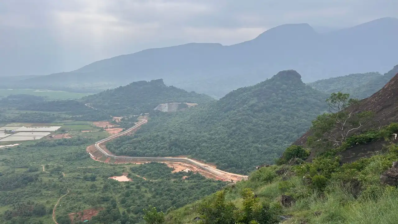
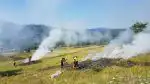
Linear infrastructure projects — highways, power transmission corridors, railway expansions — fragment continuous forest into isolated patches. The Bengaluru-Mangaluru highway widening and proposed power transmission lines through Kodagu illustrate this pressure. Fragmentation blocks wildlife corridors, preventing elephants and tigers from accessing seasonal ranges, which increases human-wildlife conflict incidents.
Mining for iron ore, manganese, and bauxite continues in ecologically sensitive zones despite regulations. Quarrying in Kudremukh, though officially restricted, persists through illegal operations that destabilize slopes and pollute headwater streams. Each ton of ore extracted removes soil that required millennia to form.
Climate change compounds existing stresses. Rainfall patterns have grown erratic over the past two decades — Agumbe recorded 8,223 millimeters in 2018 but only 4,890 millimeters in 2019. Such variability exceeds what forest ecosystems evolved to tolerate, stressing tree species and shifting suitable habitat ranges upslope faster than species can migrate.
Pathways Forward
Protecting the Western Ghats requires recognizing that environmental health and economic prosperity are not opposing choices. Water security, agricultural productivity, and climate stability all depend on maintaining forest integrity. Karnataka’s long-term prosperity rests on treating these forests as critical infrastructure rather than expendable land banks.
Communities living within the Ghats need economic models that reward conservation rather than extraction. Payment for ecosystem services schemes, eco-tourism partnerships, and sustainable harvest certifications can make standing forests more valuable than cleared land. Enforcement alone cannot protect 40,000 square kilometers of forest — only when conservation aligns with local economic interests does it become sustainable.
The Western Ghats do not exist in isolation from daily life in Karnataka. They are the reason Bengaluru has water, Mysuru has power, and Kodagu grows coffee. Recognizing this interdependence is the first step toward ensuring these forests continue functioning for generations ahead.