Forest fires pose a significant threat to Karnataka’s rich biodiversity, with the Western Ghats alone housing over 5,000 plant species vulnerable to seasonal blazes. The Karnataka Forest Department employs a multi-layered approach combining early detection, ground-level intervention, and community engagement to protect these vital ecosystems from destructive wildfires that peak between February and May each year.
Table of Contents
Early Warning Systems and Detection Infrastructure
The department has established 147 watchtowers across Karnataka’s forest divisions, staffed during high-risk months to spot smoke plumes within minutes of ignition. These towers connect to a centralized monitoring system that triangulates fire locations using geographic coordinates. Fire danger rating indices assess daily risk based on temperature, humidity, wind speed, and fuel moisture content, with alerts issued when conditions turn critical.

Satellite imagery from Forest Survey of India MODIS detection, supplements ground observations, particularly in remote stretches of the Western Ghats where human access proves difficult. District forest officers receive automated alerts when thermal anomalies indicate potential ignition points, enabling rapid response deployment. This dual-layer detection network reduces average response time from initial detection to field team mobilization to under 45 minutes in accessible zones.
Controlled Burning and Fuel Management
Prescribed fire operations occur during cooler months to eliminate accumulated leaf litter, dry grasses, and undergrowth that serve as ladder fuels during peak fire season. Trained crews conduct these controlled burns along forest boundaries and within designated compartments, creating strategic breaks that halt advancing wildfires. The practice follows strict protocols including weather assessment, firebreak preparation, and standby water sources.
Fire lines—cleared strips ranging from three to ten meters wide—segment forest blocks into manageable units. These barriers receive annual maintenance before the dry season, with vegetation cleared manually or through mechanical means. In particularly fire-prone regions like Bandipur and Nagarhole, the department maintains an extensive network of these preventive corridors that double as patrol routes and access paths for emergency vehicles.
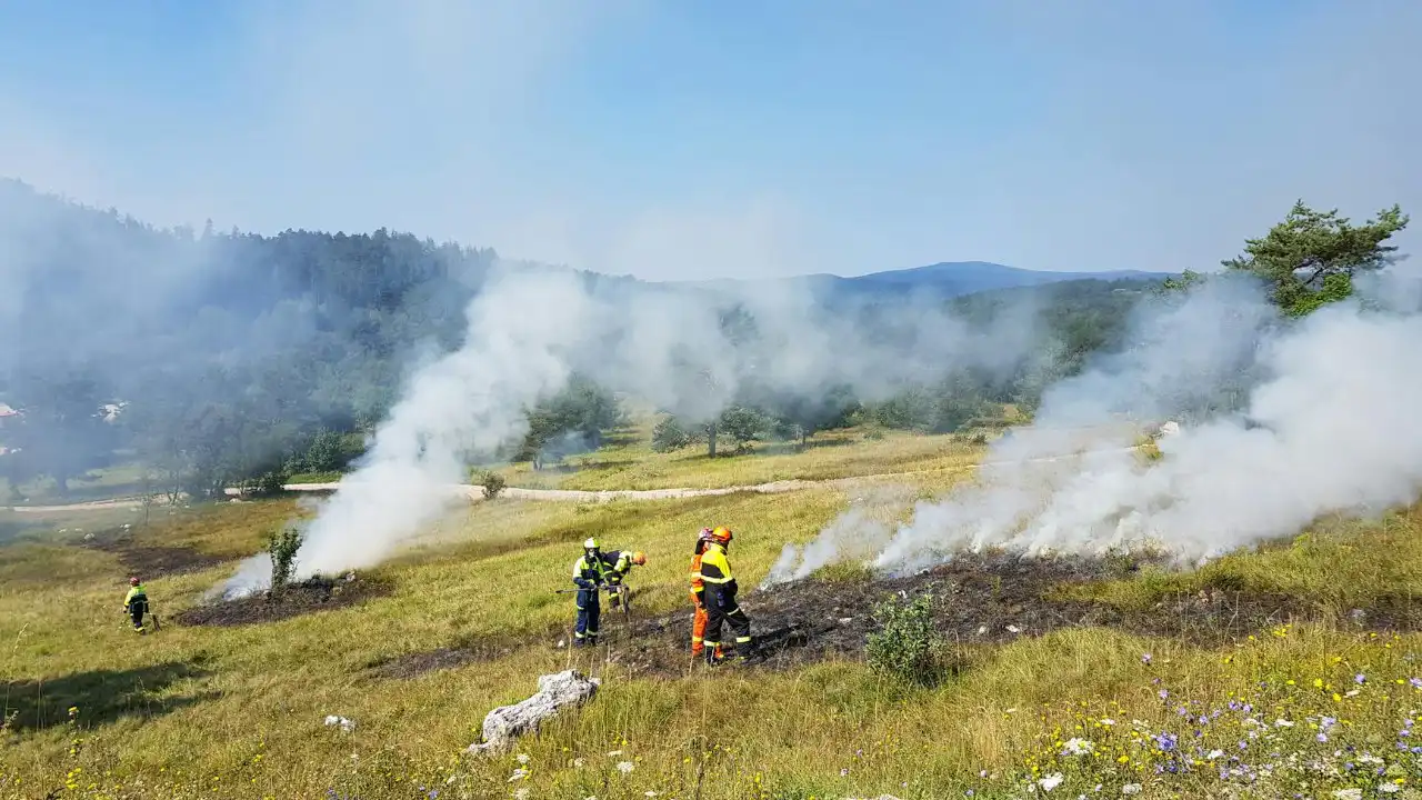
Rapid Response Teams and Ground Operations

Each forest division maintains rapid response units equipped with beaters, water backpacks, and portable pumps stationed at strategic locations. These teams undergo annual training in fire suppression techniques, safe retreat protocols, and coordination procedures. When alerts arrive, personnel deploy to containment positions while support vehicles transport additional equipment to the perimeter.
| Equipment Type | Primary Use | Coverage Area |
|---|---|---|
| Fire beaters | Direct flame suppression on low-intensity fires | Up to 500 meters per team |
| Water backpack sprayers | Hotspot cooling and ember control | Localized treatment zones |
| Portable motor pumps | Water relay from sources to fire line | Extended perimeter sections |
| Bulldozers | Emergency firebreak creation | Major fire containment operations |
Coordination with neighboring states becomes essential when fires cross administrative boundaries, particularly along the Karnataka-Tamil Nadu border in the Biligiriranga Hills. Joint suppression efforts involve shared resources, unified command structures, and real-time communication channels that prevent duplicated efforts or coverage gaps.
Community Participation and Awareness Programs
The Van Suraksha Samitis—forest protection committees comprising local villagers—form the first line of defense in many regions. These volunteer groups patrol forest edges, report suspicious activities, and assist professional crews during suppression operations. The department conducts regular training sessions covering fire ecology, safe burning practices for agricultural residue, and proper disposal of flammable materials.

Educational campaigns target schools, agricultural communities, and tourist centers, emphasizing human-caused ignition prevention. According to [CITE: Karnataka forest fire cause analysis report], approximately 60 percent of forest fires in the state originate from anthropogenic sources including discarded cigarettes, unattended cooking fires, and intentional land clearing. Awareness initiatives have contributed to measurable reductions in preventable ignitions within participating villages.
Post-Fire Assessment and Ecosystem Recovery
After containment, assessment teams document burned area extent, fire intensity indicators, and affected vegetation types. This data informs rehabilitation priorities and helps identify patterns that shape future prevention strategies. Severely damaged zones receive intervention through soil stabilization measures, erosion control structures, and selective replanting of native species.
The department monitors regeneration progress through periodic surveys tracking seedling establishment, canopy recovery rates, and wildlife return indicators. Natural succession often proves sufficient in areas experiencing low to moderate intensity burns, particularly in deciduous forests adapted to periodic fire regimes. High-intensity burns in evergreen zones require more active restoration including invasive species removal and protection from grazing pressure during critical recovery phases.
These integrated control measures reflect ongoing adaptation to changing fire behavior patterns influenced by extended dry periods and increased human-forest interface zones. Forest departments continue refining detection technology, expanding trained personnel capacity, and strengthening community partnerships to safeguard Karnataka’s forest wealth for future generations while acknowledging fire’s complex ecological role in certain forest types.